Kyoto Bike Routes Worth Riding (and the Ones to Skip)
Most Kyoto cycling routes you will find online were written by people who rode them once. Some were written by people who never rode them at all.However, NORU Kyoto Bike Tours has run these routes for ten years and I have led close to 1,000 of them.
There are routes here that deliver everything you would hope for from a bike day in Kyoto. However, there are also routes that look promising on a map and turn into a slow grind through tourist traffic.
This article offers you six routes in total. Four worth riding. Two worth skipping. And one note at the end about when the route matters less than who is riding it with you.
How to think about routes in Kyoto
The three things that determine whether a route is rideable
Three things matter when you are planning Kyoto bike routes for tourists or for yourself.
- Kyoto sits in a basin. The center is flat. The east, west, and north sides climb into hills, sometimes steeply. Our Panasonic Hurryer e-bikes are rated for the climbs, with progressive assist that cuts at 24 km/h. A regular city bike will leave you walking up half the good routes.
- Some neighborhoods are nearly empty on weekday mornings and almost impassable by mid-afternoon. The shift can happen in an hour. Most "Kyoto cycling routes" articles fail to mention this. The writer rode at one time of day and assumed that snapshot was the whole story.
- Is the route is actually worth it in 2026? Some streets that worked five years ago now have pedestrian-only sections or tighter bike-prohibited zones. The 自転車進入禁止 (jitensha shinnyu kinshi) signs at the entrances to pedestrian arcades and station plazas have multiplied. The new Blue Ticket enforcement means riding past one carries real cost.
Why the 2026 Blue Ticket law changes the route calculation
Since April 1st, I have personally seen a rise in police pulling cyclists over and questioning them in Kyoto. Routes that you could ride past or through a year ago now cost real money. A single Blue Ticket runs ¥3,000 to ¥12,000 per offense.
This matters for route choice. The "skip" routes here are not skip routes because they are unpleasant. They are skip routes because they are now most likely to put you in front of an officer.
The official Kyoto Travel cycling page is a reasonable starting point for general orientation. But it does not tell you which roads are good rides and which are slogs.
Route 1: The Kamo River corridor (worth it)
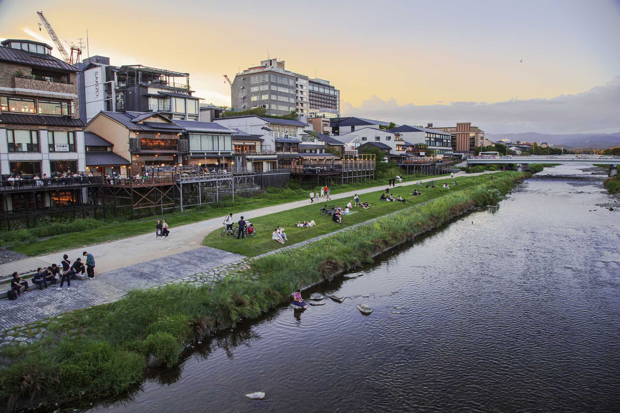
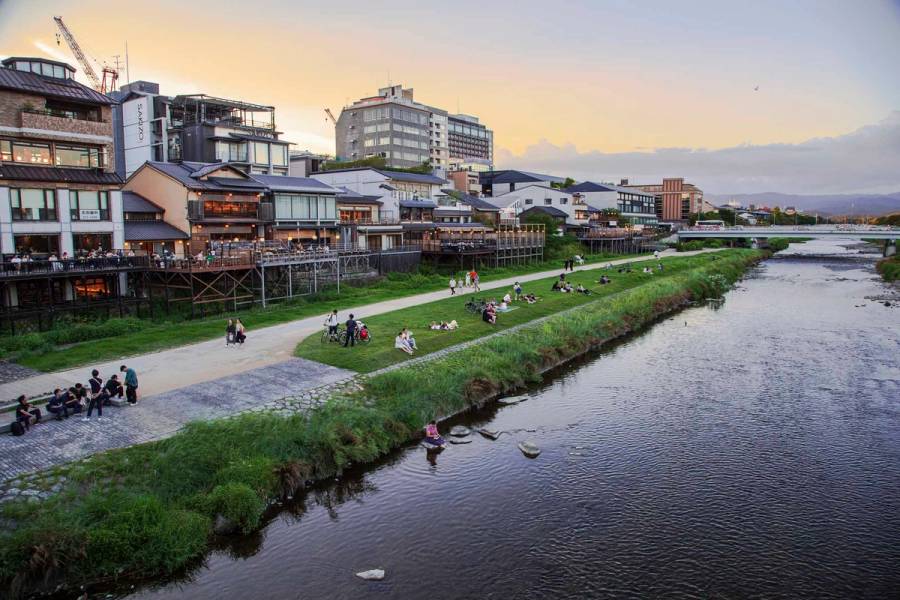
If you ride one route in Kyoto, ride this one. The Kamo River (鴨川, Kamogawa) runs north to south through the center of the city. There is a riverside path on both banks for most of its length.
The best stretch starts at Demachiyanagi, where the Kamo splits into the Kamo and Takano rivers. The triangle of land between them is the Delta, a local gathering spot. From there you can ride north along quieter stretches or south through the heart of the city.
Traffic on the path itself is light. The views shift with the season. In spring the cherry trees along the embankment are the best in the city for cyclists. You can actually look at them while riding.
Morning works best. The path gets joggers and dog walkers by mid-morning and stays busy until evening. Our tours that include this stretch depart early for that reason. For the deeper version of this route, our Kamo River cycling routes piece covers the specific stretches and stop points.
If your interested in joining NORU Kyoto Bike Tours and experiencing this area of Kyoto, please click on the link below to find out more.
Route 2: The eastern foothill loop (worth it, with conditions)
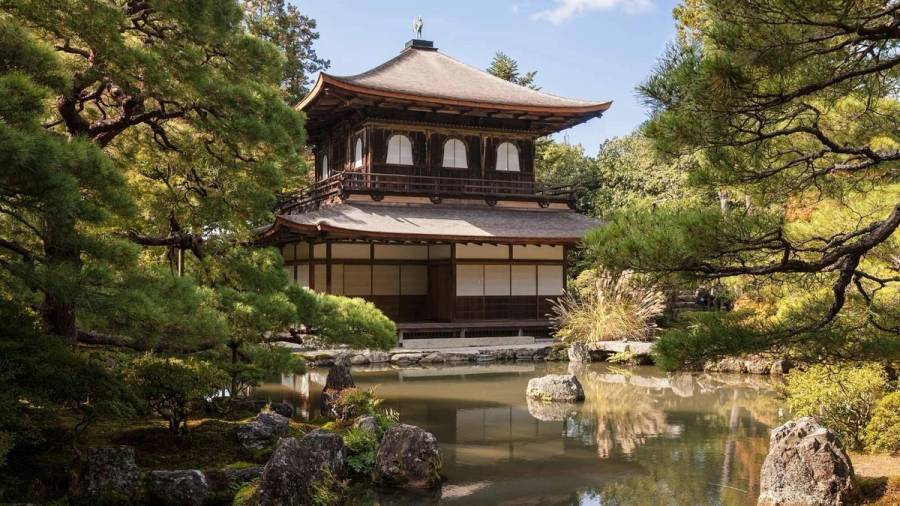
This route runs through the eastern temple belt. Nanzen-ji to Eikan-do to Honen-in to Ginkaku-ji. It is where most tourists end up wanting to ride. It is also where the gradient and the crowds start fighting you.
Why this route needs an e-bike
The climb from Nanzen-ji north toward Ginkaku-ji is not steep, but it is sustained. On a regular city bike with three speeds, you are walking sections of it. On a Panasonic Hurryer or similar Japanese-spec e-bike, the progressive assist holds you at riding speed. You arrive without breaking into a sweat. That difference matters when the next temple is half a kilometer up. You want to arrive with energy to actually look at it.
When the Philosopher's Path is not the Philosopher's Path
The conditions on this route are simple. Ride it early, ride an e-bike, and do not try the Philosopher's Path itself on a weekend. The path is a walking route. It is narrow. It fills with people taking photos.
Ride the road that runs below the path instead. It is quieter. The gradient is gentler. You still get to the same temples, and you can park properly at each one.
This route peaks twice a year. Cherry blossom in early April. Koyo in mid-to-late November. Both windows draw heavy crowds. If you ride during either, ride before 8am or you will be walking your bike most of the day.
Route 3: The Arashiyama back roads (worth it)
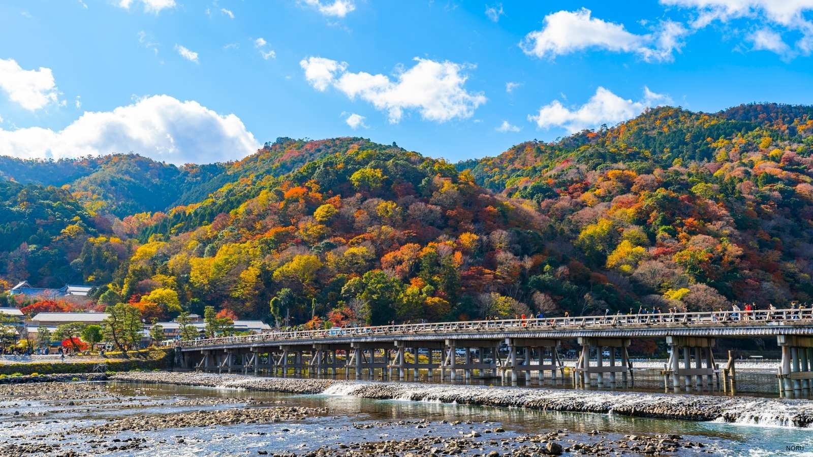
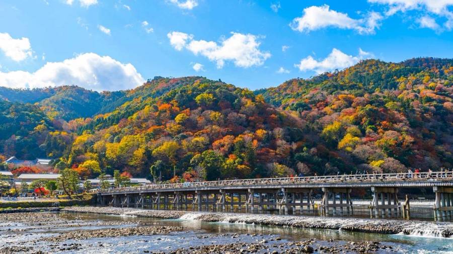
Arashiyama is the famous bamboo grove area on the city's western edge. The bamboo grove itself is a five-minute walk that takes most tourists an hour. That is how packed it gets.
Why the back roads beat the main route
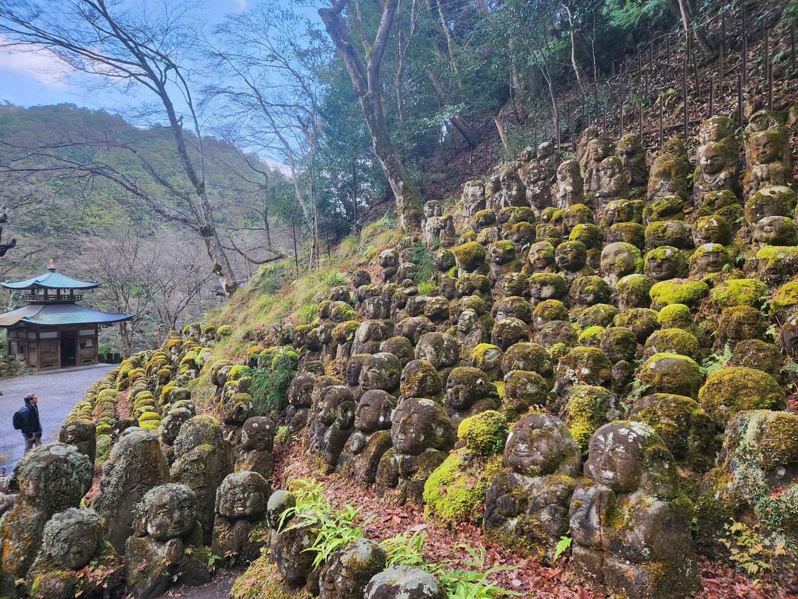
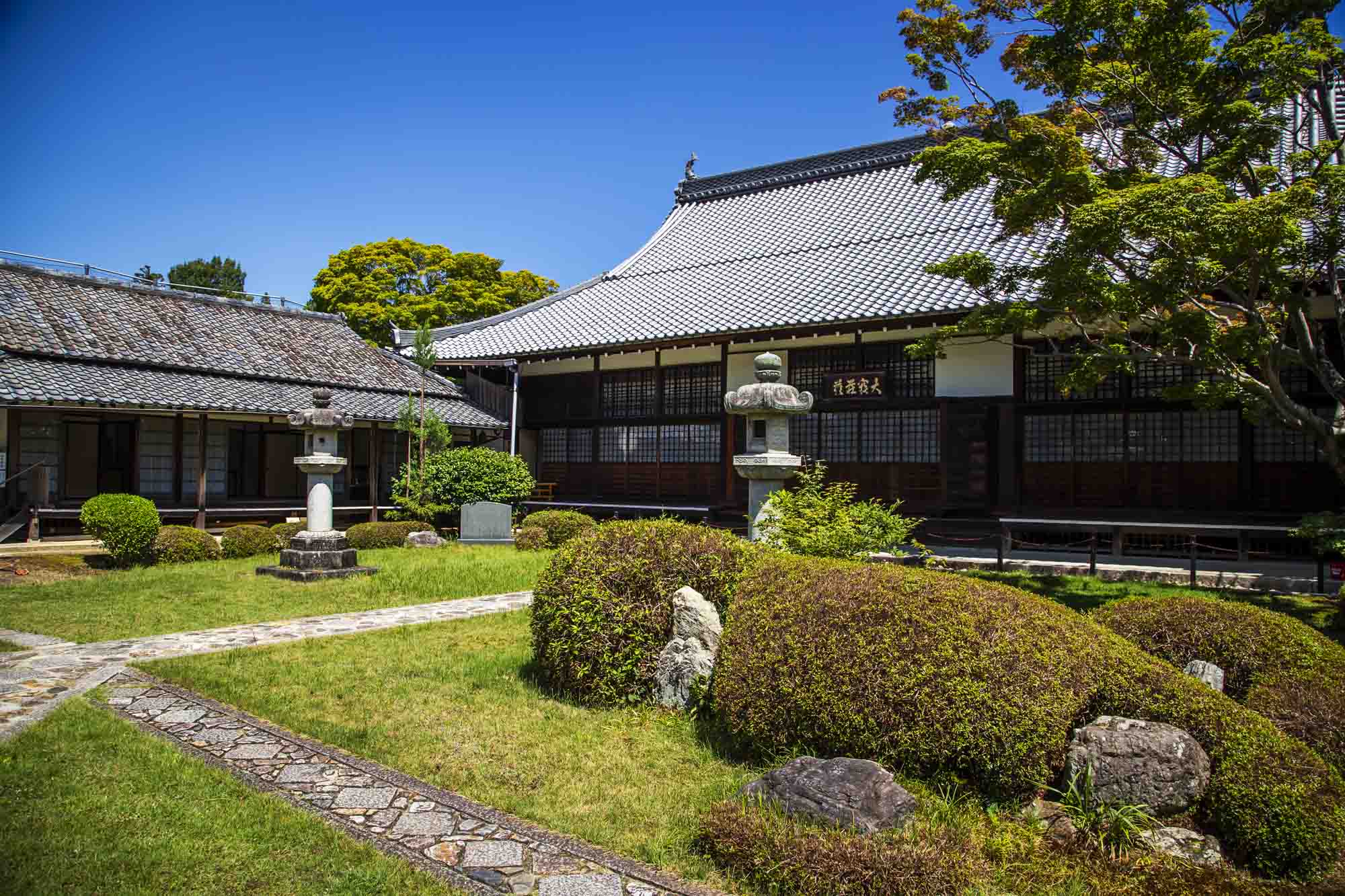
The cycling story here is different. The back roads behind Sagano and along the Hozugawa River are some of the best bike rides in Kyoto. You can ride past Tenryu-ji, through quiet residential lanes, and past Otagi Nenbutsu-ji with its hundreds of stone figures. The route continues up toward Adashino Nenbutsu-ji.
The bamboo grove is best done as a single passing glance, not a destination. Or skipped entirely on the bike and walked separately before 8am.
At NORU Kyoto Bike Tours, we offer visitors to Kyoto the opportunity to experience Arashiyama as a local and not just another tourist. Click on the link below to find out more.
How the tour version of this route works
Our Arashiyama E-Biking tour follows the back-roads version of this route. We cover about 24 kilometers and the bamboo grove is one beat in a much longer ride.
The eight-rider group cap is not arbitrary here. Larger groups cannot navigate the narrow Sagano lanes without bunching up traffic at every corner. For more on the timing trick at the bamboo grove, our Arashiyama bamboo forest piece has the specifics.
Route 4: The northern hidden temple loop (worth it)
This is where cycling in Kyoto gets quiet. The northern part of the city, away from the major temples on the standard tourist circuit, has the kind of riding the rest of Kyoto does not offer.
What makes this route work
The route climbs a little. You want the e-bike assist. The streets are narrow, residential, and almost empty of foreign visitors. There are temples here without ticket booths. There are paths that drop into quiet stands of cedars. There are tea shops where the staff have not changed in thirty years.
I am not going to name the specific stops in print. Some of these places work because they are not on every Instagram itinerary. Naming them is how they stop working.
The customer pattern that built this route
Our customers tell me afterward that this loop was the hardest part of their Kyoto trip to have found on their own. That pattern in the feedback is the reason the route exists as a tour at all. People can self-guide the Kamo River. They can muddle through Arashiyama. They almost never find this one without help, and they say so afterward.
This loop is the best version of what "hidden Kyoto" actually means for cyclists. Our Secret Kyoto E-Biking tour is built on this kind of routing.
The routes I'd skip
This is the part most cycling guides leave out. Here are three routes that look reasonable on a map and are not worth riding.
The main Higashiyama tourist road (Higashioji-dori)
Narrow, heavy traffic, no bike lane, tourist coaches pulling in and out at every temple. The bike-on-sidewalk option here is exactly the kind of riding that draws Blue Ticket attention. The police presence near these tourist routes has grown noticeably since April. For more on the new fines, see our cycling rules and routes piece.
The direct city-grid ride to Kinkaku-ji
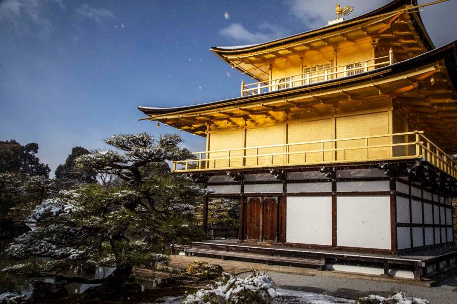
This looks like a quick shot west on Imadegawa-dori or Kitaoji-dori. In practice, it is busy main roads with no payoff scenery. There is a longer back-roads version that is worth riding. The direct version is not.
The reason this route fails for tourists is the same reason it fails for residents. The roads were built for cars, not for the kind of stop-and-look-around riding that makes Kyoto worth seeing.
The Pontocho and Gion route everyone tries
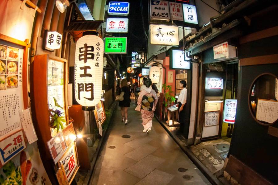
These districts are mostly pedestrian-only. Some sections are bike-prohibited outright, marked with the 自転車進入禁止 (jitensha shinnyu kinshi) signs the article opened with. Riding through here on a bicycle is either illegal, slow, or both. Walk these neighborhoods. Do not ride them.
Inside Kyoto's cycling page covers some additional route notes if you want a second local source.
When the route matters less than the guide
Here is the honest part. You can ride every route on this list and still miss what makes Kyoto worth riding in the first place.
The Kamo River corridor is a beautiful ride. It is also a beautiful ride that thousands of tourists do every week. The thing that changes the day is not where the wheels go. It is whether you know what you are looking at when you stop. Whether you know where to pause. Whether the next turn takes you somewhere you would not have found.
That is the case for a guided tour, made plainly. The same roads ridden with someone who has seen them through twenty years of seasons are a different ride. Our pre-ride briefing covers local riding law and local road etiquette before anyone touches a pedal. That part of the day is more useful than most rental shop interactions.
Frequently Asked Questions
The Kamo River corridor is the easiest starting point. It is mostly flat, traffic-light, and runs through the center of the city. The path is on both sides of the river and connects multiple districts. For more local character, try the back roads behind Sagano in Arashiyama. The northern hills between Daitoku-ji and Kamigamo Shrine deliver more reward. Both involve some climbing.
Yes, but with caveats. Kyoto's streets are laid out as a grid, which sounds simple, but the streets are long and narrow. A wrong turn at Sanjo can put you fifteen minutes off route. The Japanese-only signage on pedestrian-only and bike-prohibited streets adds risk. Confident cyclists with a planned route can manage it. First-time visitors usually wish they had a guide by midday.
The Kamo River corridor end to end is about an hour at relaxed pace. The eastern foothill loop with stops takes three to four hours. The Arashiyama back roads route is about 24 kilometers and takes about four hours with temple stops. The northern hidden temple loop covers around 14 kilometers and runs three and a half to four hours.
Yes, especially for the eastern foothills and the northern hills. The climbs are not extreme, but they are sustained. A Japanese-spec e-bike with progressive assist keeps you riding rather than walking the hills. The assist cuts at 24 km/h, which is the legal limit. But the help below that speed is the difference between a long day and an exhausting one.