After all these years in Kyoto, I still think the Kamo River is the best way to move through the city. You get the freedom of cycling, no traffic, and access to corners of Kyoto that buses never reach.
The Kamo River runs 31km from the mountains north of the city all the way south to the Yodo River. The cycling path itself stretches about 17km on both banks through central and northern Kyoto. It's flat, mostly paved, and connects some of the city's most important cultural sites with local neighbourhoods, riverside cafés, and hidden shrines.
This is where locals come to move through the city on their own terms. No queues, no tour buses, just you and the river. And it is also where I love to take out private tours.
Why the Kamo River Is Kyoto's Best Cycling Route
A Flat, Traffic-Free Path Through the Heart of the City
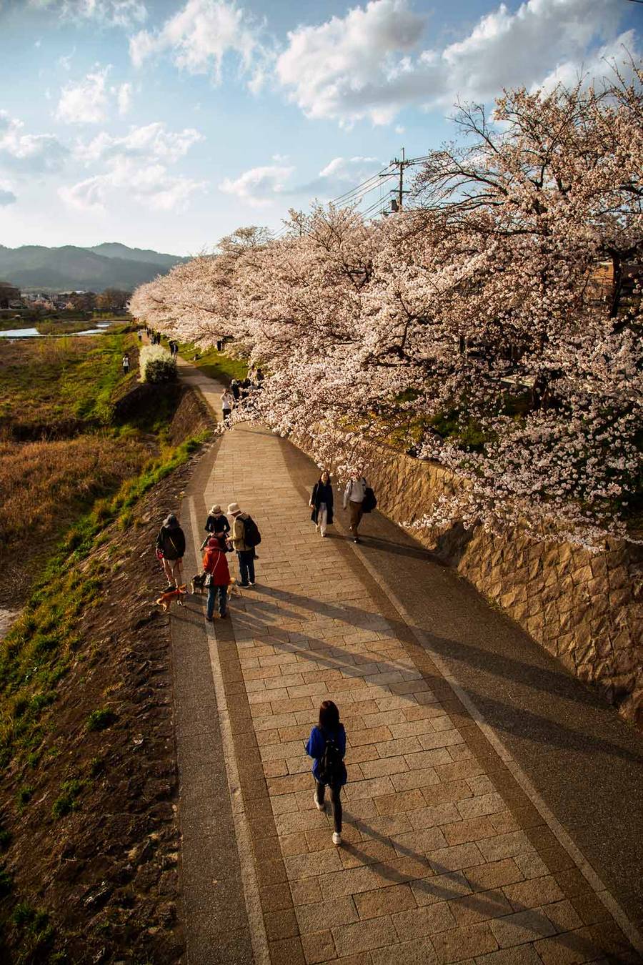
The path is dead flat. If you're nervous about cycling in cities or just don't want to deal with hills, this is your route. The central section, from roughly Kitaoji Bridge south to Gojo Bridge, is fully paved and wide enough for joggers, walkers, and cyclists to share without tension.
The path sits below street level in many places. You're removed from car traffic entirely. Buses rumble past on the avenues above, but down here it's just you, the river, and kites circling overhead hunting for dropped snacks. Watch yours.
Both banks have paths. The west bank tends to be smoother and less crowded in the central section. The east bank gives you views across to Gion district and the wooded slopes beyond. Pick whichever suits your mood.
What You'll See That Buses Can't Reach
From the Kamo River you can access UNESCO World Heritage shrines, hidden temples, and local neighbourhoods that never make the tour guidebooks. The path itself connects everything in a straight line, so you're not zigzagging through tourist crowds trying to find your way.
A guided approach helps. Read the local's guide to Kyoto bike tours to understand what you're seeing and where to stop. The river isn't just scenery, it's the spine of Kyoto's cultural geography.
The Best Kamo River Cycling Route: North to South Highlights
Kamigamo Shrine to Kyoto Botanical Gardens (Northern Section)
Start at Kamigamo Shrine, one of Kyoto's oldest shrines and a UNESCO World Heritage site. It's famous for its sand-cone purification ritual, still performed regularly. From here, the river path heads south and stays beautiful.
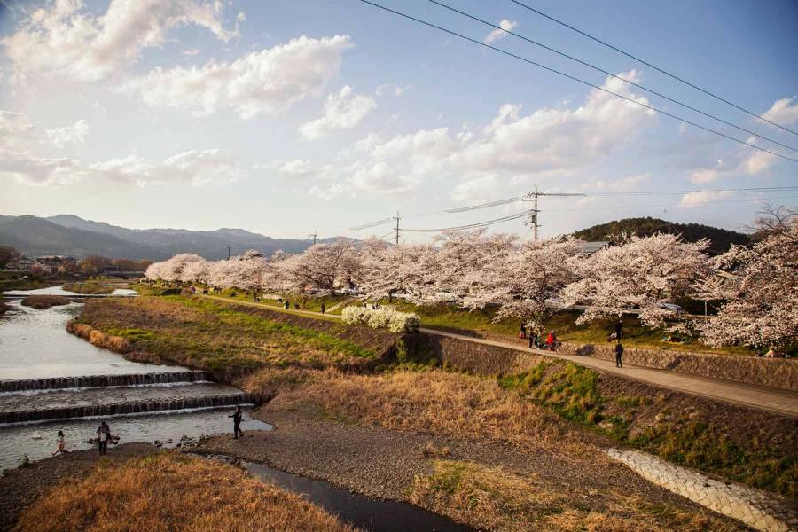
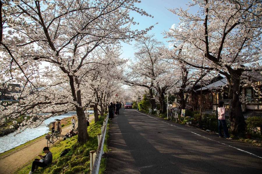
The 800m stretch between Kitaoji and Kitayama Ohashi Bridge is lined with 70 pink weeping cherry trees. In spring (late March to early April), these create a tunnel of pale pink blossoms right over the path. Ride slowly. Stop. Take time.
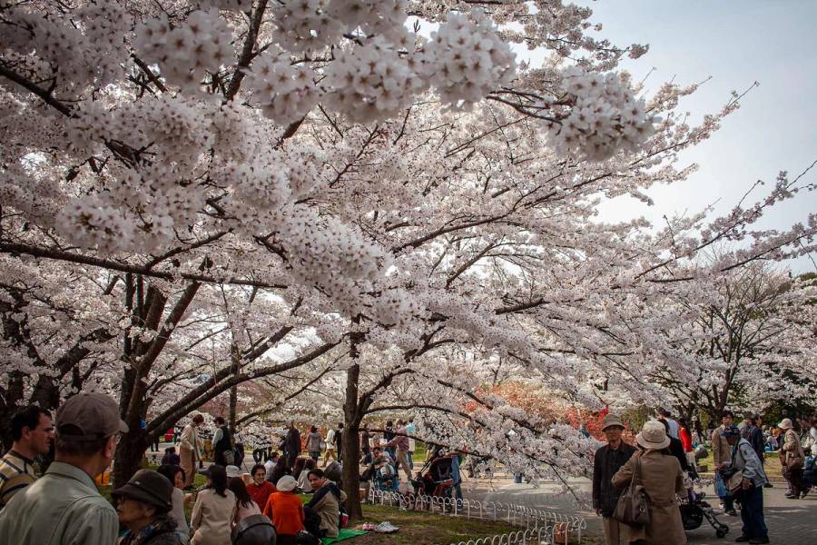
Just off the path near Kitaoji Bridge, Kyoto Botanical Garden sits right beside the water. Over 500 cherry tree varieties bloom in spring. Entry is around ¥700. You can spend an hour here or five minutes, both work.
The Kamogawa Delta and Shimogamo Shrine (Mid-North)
Where the Kamo and Takano rivers meet, a triangle of gravel and grass opens up. This is the Kamogawa Delta, near Demachiyanagi Station. It's one of Kyoto's most beloved local gathering spots.
The turtle stepping stones are the draw. Eighty-three concrete stones, many shaped like turtles and plovers, let you hop across the shallow river. They were installed in 1992. Every day, students, families, and musicians use them. Don't attempt them after heavy rain when the river rises and stones submerge.
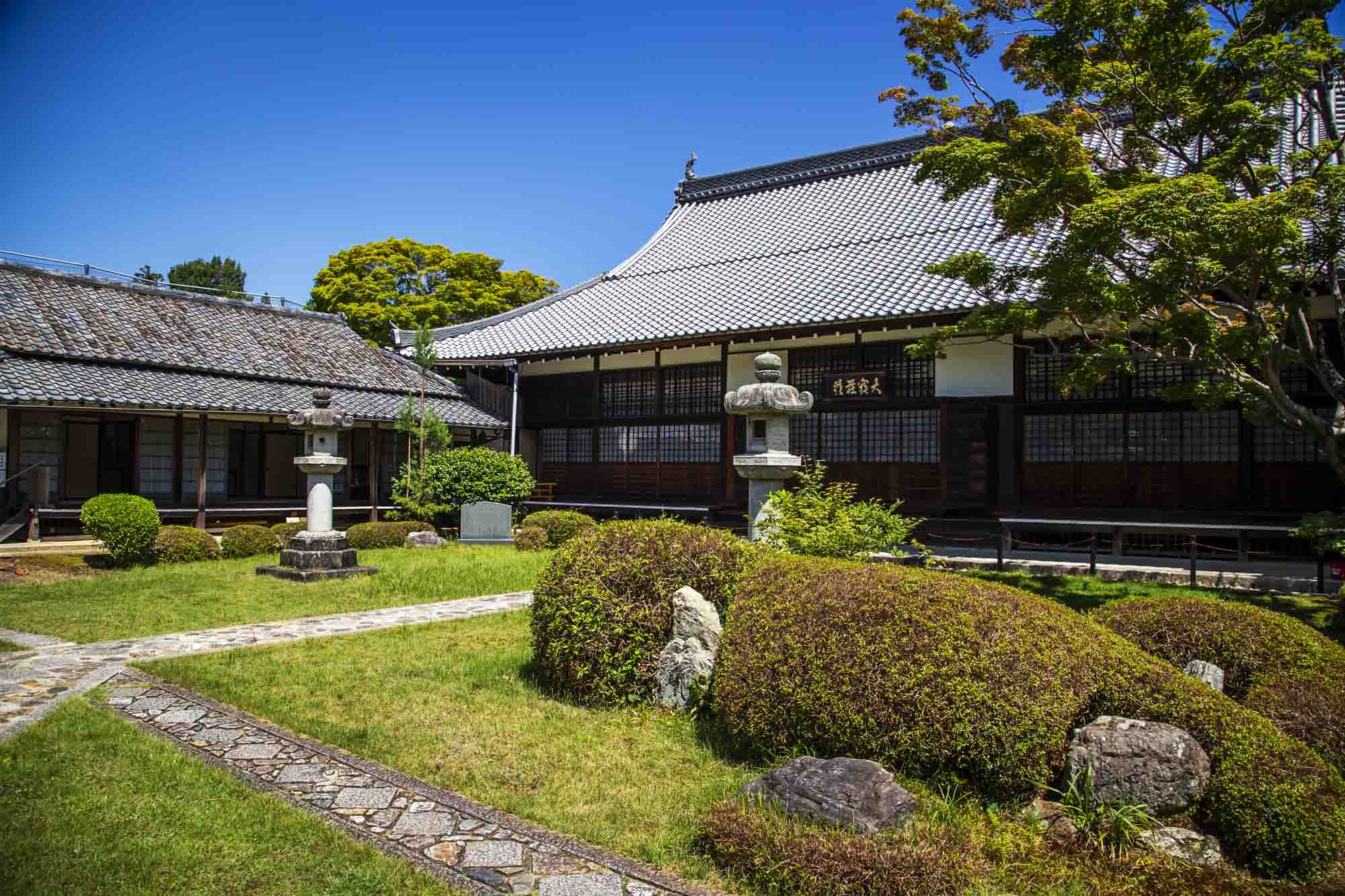
Just north of the Delta, Shimogamo Shrine anchors a primeval forest called Tadasu no Mori. Some trees here are 600 years old. The shrine opens at 6:30am and closes at 5:00pm. Entry is free. The forest is quiet even when the shrine draws crowds. Walk in early.
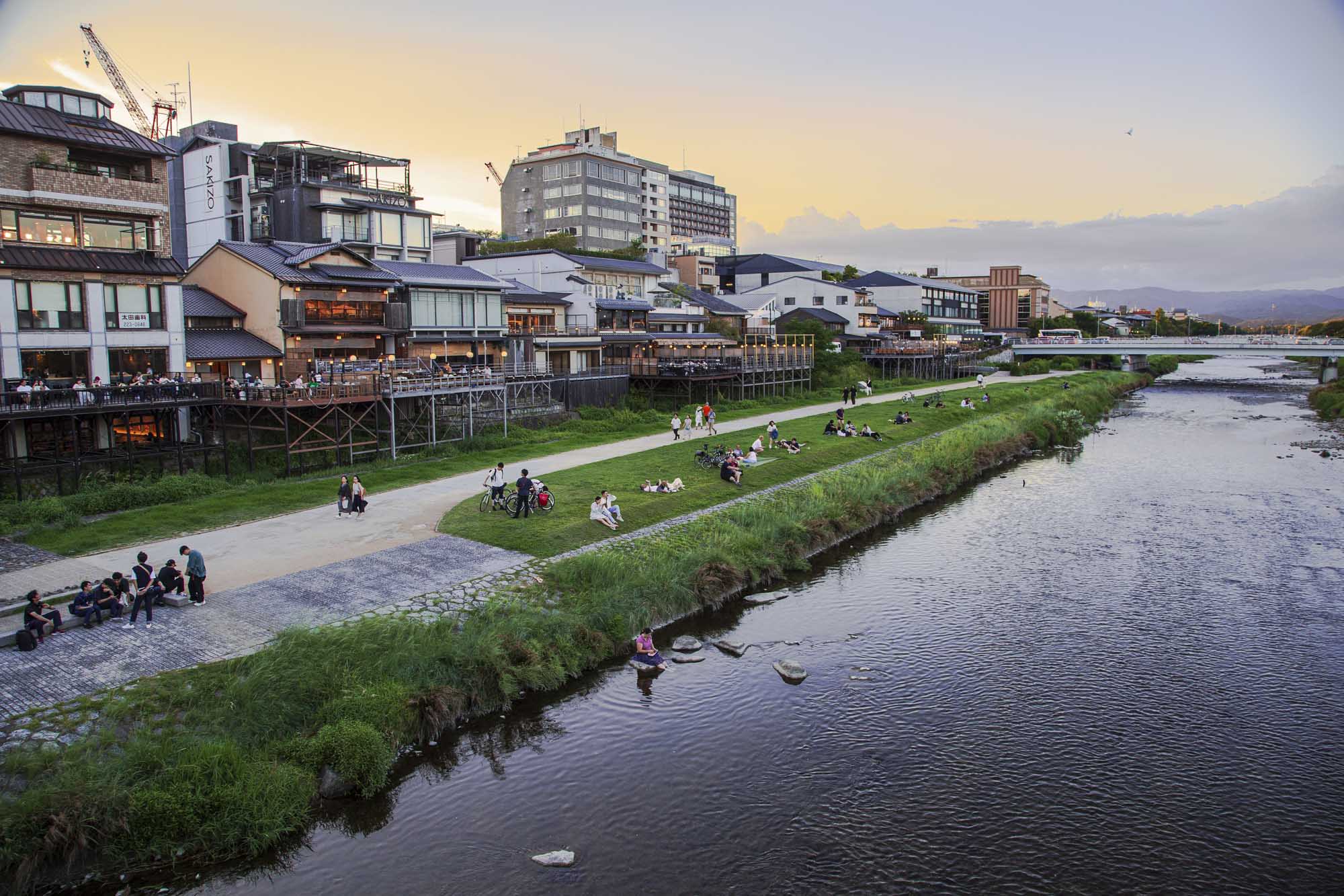
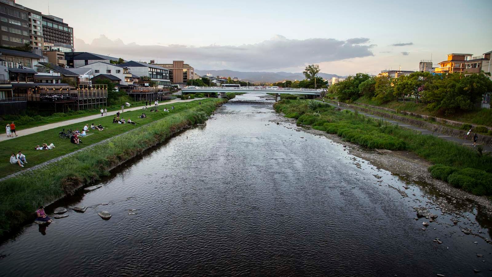
Sanjo Bridge to Gojo Bridge (Central, Gion, Pontocho, Noryo Yuka)
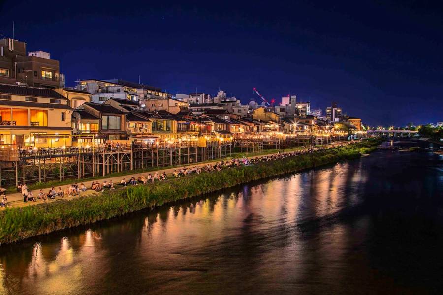
The central 2km section is where Kyoto's urban energy meets the river. On the east bank you see Gion district's timber buildings. On the west, it's more commercial, but that's where summer magic happens.
From May through October, about 90 restaurants set up noryo yuka riverside dining platforms on the west bank between Nijo and Gojo. These are low wooden terraces built right over the water. You eat or drink while the river flows beneath you. It's been done this way since the Momoyama period. Evening is best when the air cools and lanterns light up.
Prices vary wildly. Some spots serve simple yakitori and beer, others are high-end kaiseki. A few offer French or Italian. Most are open from around 5pm. Booking ahead in peak season (July, August) is essential.
The total distance from Kamigamo Shrine to Gojo Bridge is roughly 7km. On an e-bike with stops for shrines, photos, and a snack, you're looking at two to three hours. That's a proper morning or afternoon.
When to Cycle the Kamo River: A Season-by-Season Guide
Spring Cherry Blossoms (Late March to Early April)
Peak bloom typically hits the last week of March into the first two weeks of April. The Kitaoji-Kitayama weeping cherry corridor is the star. Those 70 trees are dense enough that the path feels enclosed in soft pink.
The Kamogawa Delta is packed with locals during peak bloom. Families, students, picnickers. It's busy but it's beautiful, and the energy is good. The shrine areas are quieter if you want fewer people.
Read the cherry blossom e-bike guide for exact dates and the quietest times to ride.
Summer River Life and Noryo Yuka (May to September)
Kyoto summers are hot and humid. Midday cycling is brutal. Early morning, around 6am to 9am, is when locals ride. The light is soft. The air hasn't turned to soup yet.
Evenings (5pm onward) are when noryo yuka comes alive. The platforms fill with people. Music, laughter, clinking glasses. It's a different experience entirely from day cycling. Bring a light layer, it cools down fast by the water.
The Daimonji bonfire festival on August 16 is visible from the Kamogawa Delta. A huge "dai" character is set aflame on the mountain to the east. Thousands gather along the river to watch.
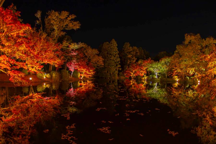
Autumn Colours and Cool-Weather Rides (Late October to Mid-November)
Ginkgo and maple trees turn golden-red. The riverbanks feel like they're on fire, but gentler than spring. The weather is perfect, 15-20 degrees Celsius. You can ride all day without overheating.
Autumn is less crowded than spring. You get the colours without the chaos. Morning light slants through the trees and catches the water. Photographers love this season.
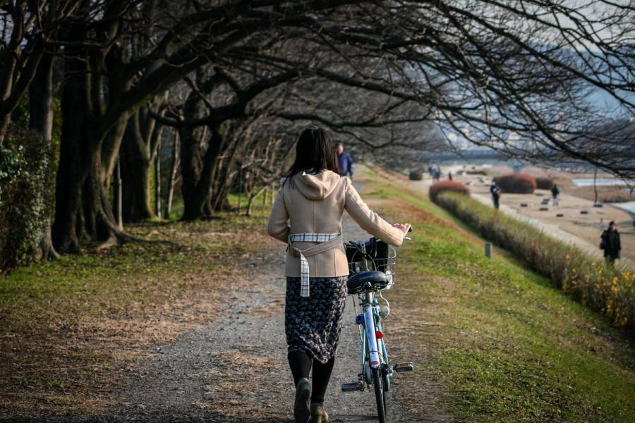
Winter and Year-Round Riding
Winter is quiet. Bare trees. The river is still beautiful in its own way. Cold, though. Dress warmly and you're fine. Snow days are rare in Kyoto but when they come, the riverbanks are stunning.
The best time to ride, any season, is early morning on a weekday. The path is nearly empty. You hear the water. You see birds. You move at your own pace.
Practical Tips for Cycling the Kamo River
Path Etiquette and Safety
The path is shared. Ring your bell gently when you pass walkers or joggers. Pass on the left. Be especially careful near the stepping stones where pedestrians might step into the path without looking.
Both banks are usable. If the west bank feels too crowded, cross at a bridge and try the east side. The path quality varies. Central sections are smooth asphalt. The far north and south drift into hard-packed gravel.
Bathrooms are scattered along the route, roughly every 2-3km. Distance markers help you track your progress. Entry and exit points exist at most major bridge crossings, so you're never trapped on the path.
Stepping stones get slippery in rain and can submerge if the river rises. Don't try to cross in wet conditions. Wait for normal water levels.
How to Combine the Kamo River with a Guided E-Bike Tour
An e-bike makes this route effortless. You cover 7km with stops without getting tired. You can linger at shrines or have a proper breakfast break without worrying about your legs.
Our Secret Kyoto E-Bike Tour includes quiet riverside cycling through north Kyoto, stops at Kamigamo and Shimogamo Shrines, and the Kamogawa Delta. It's built around exactly this landscape. You get the river path plus context from someone who knows Kyoto's history and current rhythm.
For families with kids under 13 or groups wanting full custom itineraries, a private tour lets you combine the Kamo River with specific temples or off-path neighbourhoods that interest you.
---
The Kamo River is Kyoto's quietest major cycling route. It connects shrines, neighbourhoods, and seasons in one long, flat path. You can ride it alone, drift through at your own pace, and discover why locals never leave.
If you want to explore this route with why e-bikes beat walking in Kyoto, our Secret Kyoto E-Bike Tour covers the northern section from Kamigamo Shrine through the Kamogawa Delta and Shimogamo Shrine, with stops at hidden corners and local landmarks you won't find on standard routes.
Frequently Asked Questions
Yes. Bike paths run on both banks for about 17km through Kyoto, from north of Kamigamo Shrine to the Katsura River junction in the south. The central section is fully paved, while the far north and south stretches may turn to gravel.
Yes. The Kamo River path is one of the flattest cycling routes in Kyoto and suits all fitness levels. It's even easier on an e-bike. There are no hills and few major road crossings in most sections.
At the Kamogawa Delta near Demachiyanagi Station, 83 concrete stepping stones, some shaped like turtles and plovers, let you hop across the shallow river. They were installed in 1992 and are a popular local landmark. Avoid crossing after heavy rain when the stones go underwater.
Early morning works well: cooler temperatures, fewer people, and good light for photos. Weekday mornings are the quietest. Evenings are also worth considering, especially in summer near the noryo yuka riverside dining platforms.
Yes. Cherry trees line the riverbanks, especially north of Demachiyanagi. The stretch between Kitaoji and Kitayama bridges features 70 weeping cherry trees. Peak bloom is typically late March to early April.